East Gippsland, Victoria: The Complete 4WD, Camping and Caravan Guide for 2026
East Gippsland is one of Victoria's most underrated outdoor destinations — a sprawling region of ancient rainforests, glacial lakes, remote coastal tracks, and rugged high country that stretches from the Snowy Mountains all the way to the New South Wales border. For 4x4 drivers, caravanners, and serious campers, it delivers experiences that rival anywhere else on the continent, yet without the crowds you find at better-known spots further west.
This guide covers the best of what East Gippsland has to offer in 2026: where to camp, which 4WD tracks are worth the effort, how to navigate the Gippsland Lakes system, and the practical gear and connectivity solutions you need to get the most out of a region that can genuinely keep you busy for weeks.
The Gippsland Lakes: Camping, Fishing and Getting Off the Beaten Track
The Gippsland Lakes form the largest inland waterway system in Australia — a network of interconnected lakes, lagoons, and coastal parkland stretching from Sale in the west to Mallacoota in the east. For caravanners and campers, Lakes Entrance is the most popular base, but the real magic is found further into the system where vehicle access thins out and the crowds disappear entirely.
The Gippsland Lakes Coastal Park is where things get genuinely interesting for 4x4 travellers. Soft sand tracks wind through coastal heath and banksia woodland to some of the most secluded campsites in Victoria. Many of these sites are accessible by 4WD only, and require deflated tyres and a basic level of sand-driving experience. Booking ahead through Parks Victoria is strongly recommended for peak holiday periods, though first-in, first-served free sites are available off the Loch Sport Road for those travelling without a fixed itinerary.
Lakes Entrance as a Base Camp
Lakes Entrance is the natural hub for exploring the eastern lakes and coastal park. The town sits on the narrow strip of land separating Lake King from Bass Strait, and the range of caravan parks, boat ramps, and supply shops makes it an excellent staging point before heading into more remote terrain. Fuel up, fill the water tanks, and stock the fridge before pushing east.
From Lakes Entrance, the drive along the Princes Highway to Orbost and then north into the Snowy River country takes around 90 minutes and opens up a completely different side of the region. This transition from coast to high country is one of East Gippsland's great strengths — the diversity of terrain available within a day's drive is exceptional.
Fishing in the lakes system is outstanding year-round. Bream, flathead, luderick, and Australian bass are all present in good numbers, and the brackish estuary environment attracts species you won't find further inland. A small tinnie or kayak is ideal for working the shallow edges of Lake Victoria and Lake Wellington, and the lack of strong tidal movement makes conditions manageable even for less experienced boaters.
Ninety Mile Beach — Remote Coastal 4WD Camping
Ninety Mile Beach is exactly what the name suggests: an almost unbroken stretch of surf beach running from Golden Beach in the west to Seaspray and beyond. The beach is accessible by 4WD at several points, and the remote coastal camping available here is among the best in Victoria. There are no facilities, no powered sites, and no neighbours — just open ocean, clean sand, and the kind of sky you only get when there's no light pollution for hundreds of kilometres.
Entry points off the South Gippsland Highway and Loch Sport Road lead onto the beach via soft sand tracks. Tyre pressures should be dropped to around 16–18 psi for beach driving, and a recovery kit including a snatch strap and MaxTrax boards is essential. The ocean beach itself is not particularly technical 4x4 terrain, but the soft sand tracks leading to and from the beach can catch out drivers who aren't paying attention. Stay in existing wheel tracks where possible and watch the tide — some sections of the beach narrow significantly at high water.
Keep in mind that a beach driving permit is required to drive on Ninety Mile Beach, available from the relevant Parks Victoria management area. Rules around camping zones and fire restrictions change seasonally, so check the Parks Victoria website before you go.
Metung, Paynesville and the Quieter Side of the Lakes
Metung and Paynesville are two small towns on the western edge of the lake system that attract a more relaxed crowd — holiday houses, sailing boats, and long lunches rather than 4WD tracks and heavy swags. Both make excellent overnight stops for caravanners working their way east, with good facilities, friendly caravan parks, and easy access to the water. Paynesville is also the jumping-off point for Raymond Island, home to one of Victoria's largest wild koala populations, which is a worthwhile short detour if you're travelling with family.
East Gippsland 4WD Tracks: High Country and Remote Backcountry
North of the lakes and coast, East Gippsland transitions into serious high country — steep forested ridgelines, narrow mountain tracks, and river crossings that test both vehicle and driver. This is where the region earns its reputation among the 4x4 community. The tracks here are remote, often unmarked on basic navigation apps, and require genuine preparation. A solid Hema map set, a full-size spare, and reliable communications are non-negotiable.
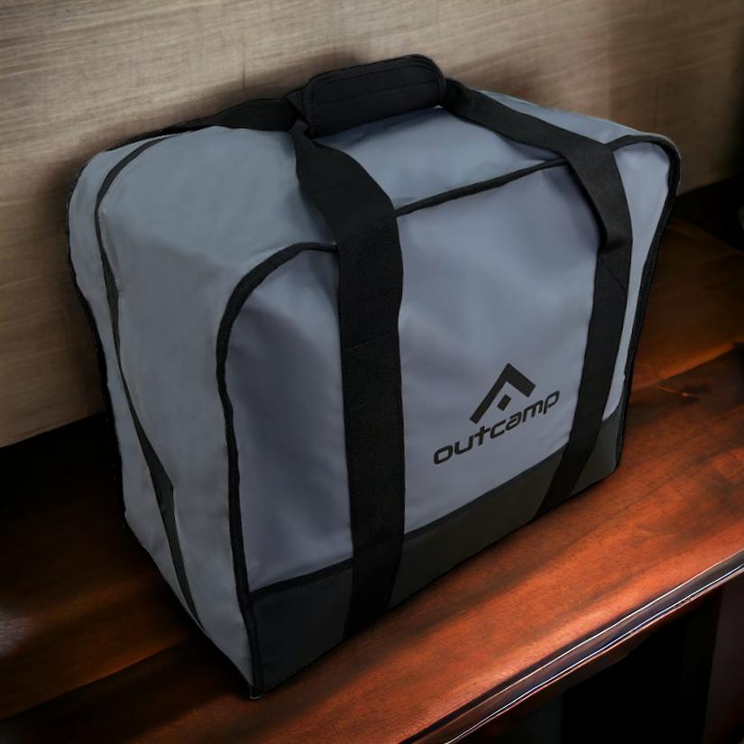
For those travelling with Starlink, East Gippsland's high country is one of the best use cases in Victoria. Mobile coverage is patchy and unreliable once you leave the main highway corridors, and satellite internet gives you a genuine safety net for weather updates, park fire ban information, and emergency communication. A Starlink carry bag that protects the dish from track vibrations and dust is worth having — the corrugated mountain roads will test any gear that isn't properly secured.
Billy Goat Bluff and the Dargo Area
Billy Goat Bluff is one of the most iconic 4WD tracks in Victoria, and for good reason. The climb from the Wonnangatta Valley floor to the bluff summit is steep, heavily rutted in places, and genuinely challenging — a one-way track that concentrates the mind and rewards with views across the Central Gippsland ranges that are difficult to match anywhere in the state.
The base of operations for most Billy Goat trips is the small town of Dargo, around 320 kilometres northeast of Melbourne via the Great Alpine Road. Dargo itself is a tiny community but has fuel, basic supplies, and a pub that has served as a welcome endpoint for countless 4x4 expeditions. The surrounding Wonnangatta-Moroka National Park offers days of additional exploration for those with time to spare, with historic huts, river camps, and tracks that intersect and branch throughout the high country.
Water crossings on the Wonnangatta River are a consistent feature of any multi-day trip in this area. Read the current crossing depths carefully — the river can rise quickly after rain, and what looks manageable in the morning can be impassable by afternoon after a storm further upstream. Check flow data through the Victorian Water Monitoring website before committing to river crossings in this area.
Snowy River National Park
The Snowy River National Park protects the largest area of national park in Victoria and contains some of the state's most dramatic canyon scenery. The river itself cuts deep gorges through the Pilot Wilderness, and the walking tracks along the rim provide genuinely spectacular views without requiring 4WD. For those with the right vehicle and preparation, however, the park has a network of fire roads and management tracks that penetrate deep into the wilderness.
The drive between Buchan and Orbost via the Snowy River road is one of Victoria's great back-road drives — suitable for high-clearance 4WDs, though a well-set-up caravan can make the journey with care. Buchan Caves is worth a stop en route, particularly if you haven't seen the Royal Cave formations, which rival anything in the country.
Wild camping along the river corridor is an experience that stays with you. The canyon walls muffle the outside world completely, and at night the combination of moving water and absolutely no light pollution creates the kind of darkness that most Australians rarely experience. A quality sleeping system and the right camp setup matters here — temperatures can drop sharply at night even in summer, and the canyon environment holds moisture.
Errinundra Plateau
The Errinundra Plateau is the oldest and least disturbed area of cool temperate rainforest in Victoria. Ancient myrtle beech and Errinundra shining gum trees rise from a fern-covered understorey, and the tracks through the plateau feel genuinely remote even though the surrounding area is actively managed. The plateau is accessible by a range of tracks off the Bonang Highway, with varying conditions that depend significantly on recent rainfall.
This is slow, absorbing terrain — the kind of place where you find yourself stopping constantly to look up through the canopy. The atmosphere is different from the open alpine country further west, and the change of pace it demands is part of its appeal. Accommodation options are limited to bush camping on the plateau itself, and campfires are often restricted due to the sensitive ecosystem. A self-contained camp setup with a good gas cooker is the right approach here.
Practical Planning for East Gippsland in 2026
East Gippsland rewards preparation. The distances involved are greater than they appear on a map, the tracks are not maintained to a uniform standard, and the weather — particularly in the high country — can change rapidly at any time of year. Getting the basics right before you leave means you spend your time exploring rather than managing problems in the field.
The best time to visit depends on what you want to do. Summer (December to February) is peak season for the coastal areas and Gippsland Lakes, with warm water temperatures and long daylight hours. The high country tracks are generally accessible from December to April, though snow can close alpine routes into late October and occasionally through November. Spring (September to November) is excellent for the coast, with lower visitor numbers and wildflowers in the coastal heath at their best. Autumn brings cool nights and the first colour changes in the high country deciduous plantings around Bright, which is within range of an East Gippsland base.
Vehicle and Gear Preparation
A well-set-up 4WD is the right vehicle for East Gippsland if you want to access the full range of experiences on offer. You don't need an extreme build — a standard GVM-rated dual-cab with a lift, decent all-terrain tyres, and a full-size spare covers most of what the region demands. A basic recovery kit (snatch strap, shackles, MaxTrax), a quality high-lift jack, and a tyre repair kit round out the essentials.
For caravanners, the coastal park and Lakes Entrance area is excellent — good roads, well-maintained sites, and easy access to supplies. Pushing into the high country with a caravan requires careful research. Some mountain roads will handle a well-balanced off-road caravan; others will not. The Hema East Victoria Explorer map set is the reference of choice for anyone navigating the back roads seriously.
Power management is worth thinking about on longer trips into the region. The high country in particular has very limited opportunity to plug in, and the shaded canopy of rainforest areas reduces solar yield significantly. A LiFePO4 battery bank with enough capacity to handle 3–4 days of off-grid camp power is a sound investment for extended East Gippsland trips. For connectivity, a Starlink Roam plan with a quality dish-mounting and carry solution provides reliable internet access even in areas where mobile networks have given up entirely.
Leave No Trace and Conservation in East Gippsland
East Gippsland's ecosystems are genuinely fragile. The cool temperate rainforests of the Errinundra Plateau have taken thousands of years to develop; a single careless visit can damage understorey growth that won't recover within a lifetime. The basic principles apply: stay on formed tracks, pack out all waste, keep campfires within designated rings, and observe all Total Fire Ban days without exception. During and after drought years, fire risk in the East Gippsland forests is extreme.
Weed hygiene matters particularly in this region. Check your vehicle and gear — particularly the undercarriage and wheel arches — for seeds and plant material before entering national park areas. Several invasive weed species are actively spreading along 4WD track corridors in East Gippsland, and every trip is an opportunity to slow that spread rather than accelerate it.
The Aboriginal cultural heritage of East Gippsland belongs to the Gunaikurnai people, the traditional custodians of the land. Artefacts, shell middens, and cultural sites are protected under Victorian law — if you encounter anything that looks like a cultural site, treat it with respect, don't disturb it, and report it through the appropriate channels rather than sharing specific location details online.
Staying Connected in Remote East Gippsland
Mobile coverage in East Gippsland is patchy at best. The main highway corridors through Bairnsdale and the coastal route to Mallacoota have reasonable Telstra coverage, but as soon as you head north into the mountains or east into the more remote coastal park areas, mobile signals become unreliable. Satellite communication is the only genuinely dependable option for remote travel in this region.
A Starlink Mini or Starlink Standard with a compact carry bag designed for vehicle travel gives you real-time weather, fire ban updates, emergency communication, and the ability to work remotely even from a camp in the Snowy River gorge. Paired with a reliable 12V power setup, it's the single most useful connectivity solution for extended East Gippsland travel. Outcamp's range of Starlink mounts and carry bags are designed specifically for the kind of rough track conditions you'll encounter in the region — protecting the dish on corrugated mountain roads and making setup at camp straightforward after a long day behind the wheel.
Where East Gippsland Sits in the Victorian Camping Calendar
East Gippsland is a genuine all-season destination with different strengths depending on when you visit. The key is matching the region you want to explore with the right window — coast in late spring and early autumn, high country in summer, and the rainforest tracks at any time of year outside of prolonged wet periods. Unlike the more popular parts of Victoria, East Gippsland rarely reaches capacity even during school holidays, and the further east you travel, the more space you find.
For 4x4 drivers, it offers some of the most technically varied and scenically rewarding terrain in the state. For caravanners, the lakes system and coastal park are among the best in southern Australia. For campers who want genuine remoteness without crossing into the Northern Territory, the Snowy River corridor and the Errinundra Plateau deliver experiences that are hard to find anywhere else in Victoria.
If you're planning a 2026 East Gippsland trip, start the booking process for Parks Victoria campgrounds early — peak season coastal sites at Gippsland Lakes Coastal Park fill quickly. Build in at least two weeks if the high country is on the itinerary; this is not a region that rewards rushing. And make sure your connectivity and power setup is dialled in before you leave — once you're north of Orbost on the Bonang Highway, you're genuinely on your own.